STRAITS
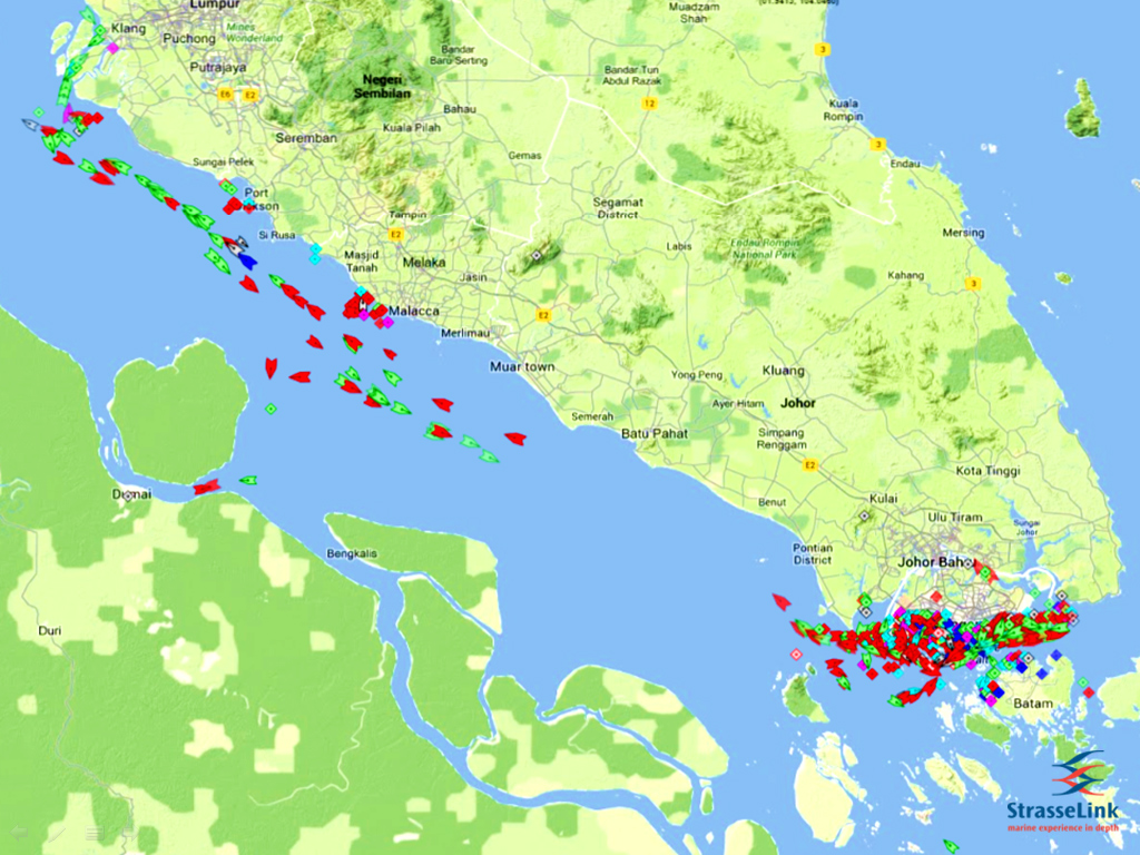
AIS grab showing average no. of vessels passing through Malacca/Singapore Straits
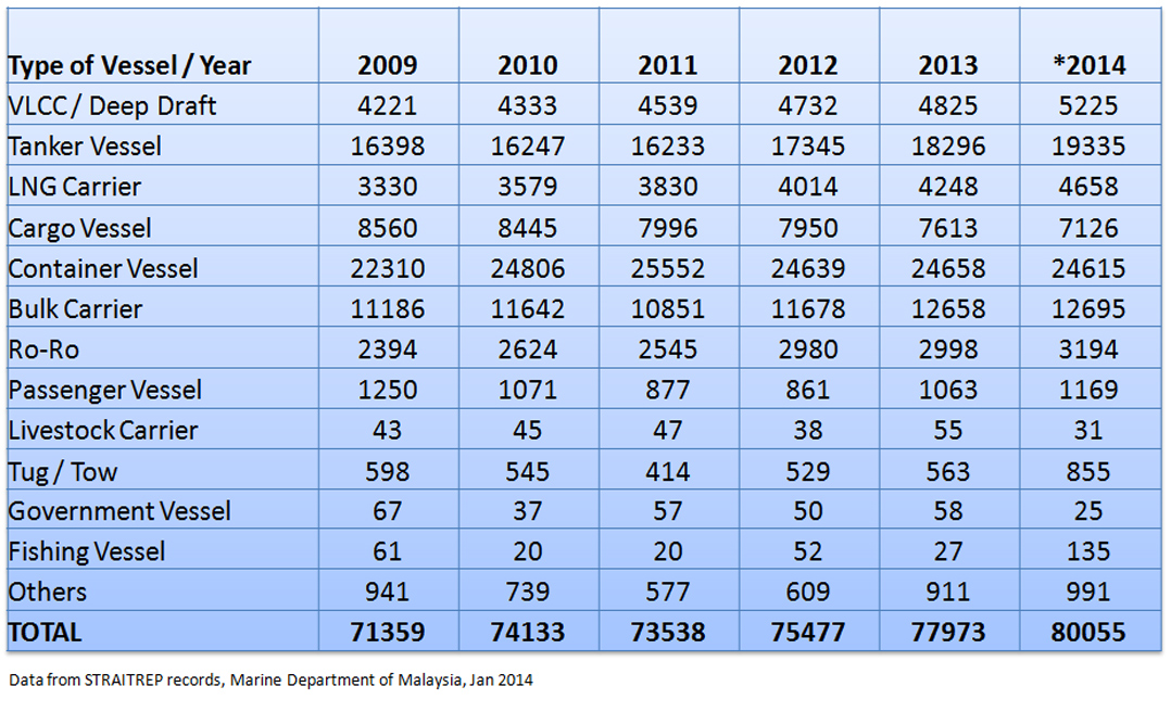
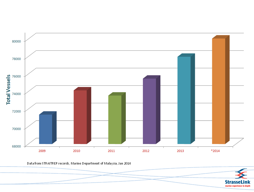
The Malacca and Singapore Straits is the primary route for vessels plying between the Far East, the oil rich states in the Middle East and ports along the way. Currently, the Straits of Malacca and Singapore bear more than 100,000 vessel movements per year. When cross-straits ferry and other traffic are included, the total exceeds 500 vessel movements per day. The greater number of ships plying in these straits means more risk, especially when such ships are concentrated at chokepoints. Moreover, traffic in the Straits is predicted to double in the next ten years, making the Straits the most congested in the world.
The route through the Straits of Malacca and Singapore is beset with challenges, natural and man-made. The region is subject to frequent rain and squalls while strong currents can be experienced during the transit through the Straits. During squalls and haze, visibility can decrease considerably to make it difficult for mariners to navigate their vessels through the Straits.
The most difficult stretch for navigation in the Straits of Malacca and Singapore is in areas spanned by the Traffic Separation Scheme (TSS) between One Fathom Bank off Port Klang (Malaysia) in the west and Horsburgh Lighthouse (Singapore) in the east. The TSS extends for 250 nautical miles and has six choke points with average depth of about 23 metres.
The high shipping traffic coupled with the narrowness of the Straits make for navigational hazards. The narrowest breadth along the Strait of Singapore is off the southern tip at Phillips Channel, where it is about 1.96 nautical miles. Other navigational hazards in the Straits include ship wrecks; small islands, isles and shoals in the south-eastern exit of the Strait of Singapore and unreliable aids to navigation, especially in the Indonesian portion of the Straits.
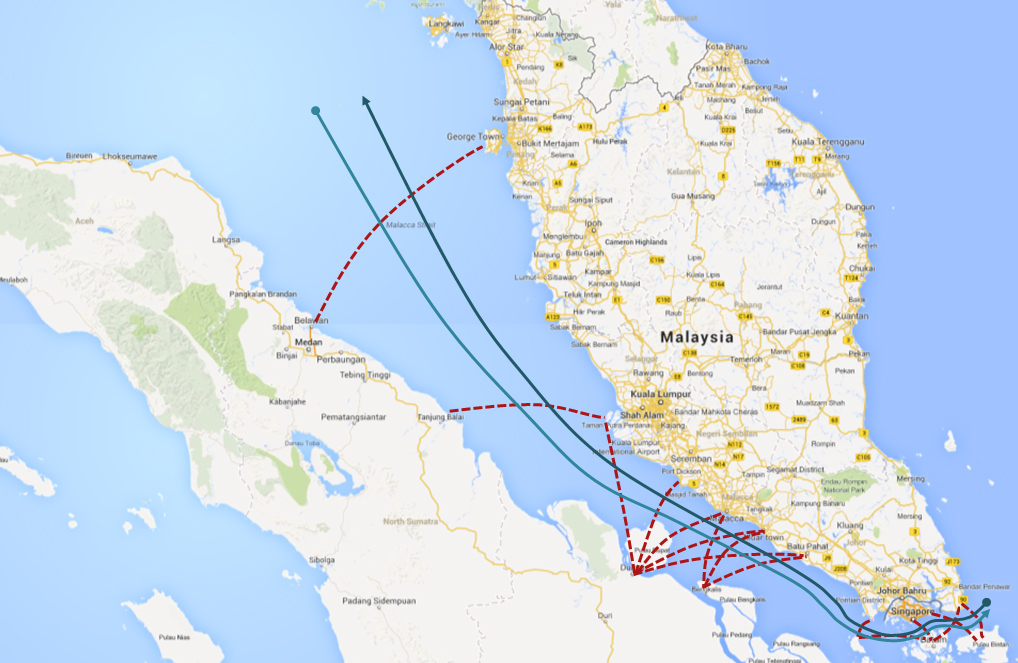
Cross strait traffic in the Malacca/Singapore Straits
The Straits of Malacca and Singapore also accommodate cross-strait traffic or coastal shipping, particularly in the TSS area. Since 2008, the steady increase of coastal shipping has been identified as one of the impediments to safe navigation of through traffic. Piracy and sea robbery activities also complicate navigation, though since 2006 the number of sea robbery incidents has gone down due to effective security measures by the littoral States, such as the coordinated naval patrols by Indonesia, Malaysia and Singapore.
However we have recently witnessed piracy activities resurfacing especially in the vicinity of Nipa anchorage off Indonesia.
Haze caused by forest and bush fires in Sumatra has also compromised safe navigation through these waterways and it remains a threat to mariners until today. The haze caused by forest and plantation fires could at times severely affect visibility forcing Malaysia to issue a hazard warning for ships sailing in the Strait of Malacca.
Human errors are also a significant form of navigational hazard when assessing risks to the marine environment of the Straits. The tighter sailing schedules, shorter turnaround times in ports have contributed to the increasing risk of crew fatigue and intense stress by the crew members.
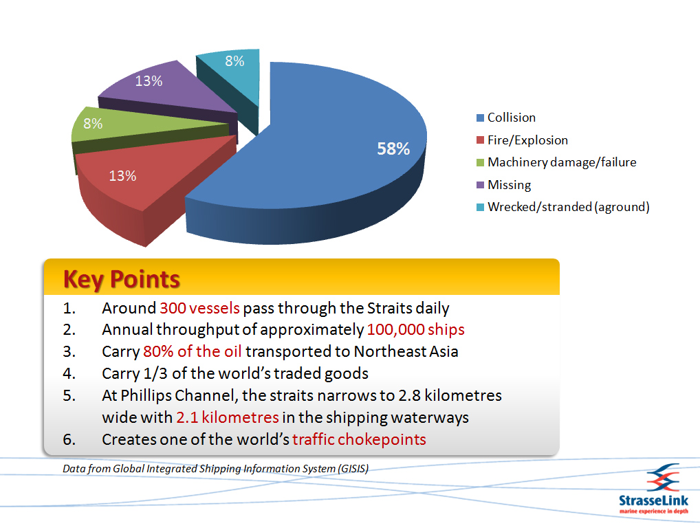
Statistics of accidents in the Malacca / Singapore Straits

- phone:

- email:
© Copyright 2014